How Drones Are Transforming Public Safety: From First Response to Prevention
Drones have been on the scene in U.S. public safety since 2011, when an unmanned aerial vehicle (UAV) assisted in an arrest in North Dakota. A decade and a half later, this technology isn’t just supporting responders — drones are often first on scene. In Redmond, Washington, UAVs consistently arrive in under three minutes, often beating ground units to calls. And in Chula Vista, California, the average drone rushes to a “first on scene” case in under 96 seconds, giving dispatchers and officers a live aerial view before the first patrol car hits the street.
Fueled by streamlined Federal Aviation Administration (FAA) rules and new grant funding, drone-as-first-responder (DFR) programs are gaining traction nationwide. The global market for drones in public safety is projected to nearly triple to $3.4 billion by 2034, a nod to the expanding role of drones in faster, safer, and more cost-effective emergency response and prevention.
Add to that the arrival of AI-powered technology for collecting and analyzing drone data, and the stage is set for UAVs to revolutionize public safety. Tools like gNext can help agencies turn drone missions into actionable intelligence, whether it’s mapping a crash scene, assessing fire damage, or coordinating disaster relief.
Here’s how drone-as-first-responder programs are transforming police, fire, and emergency management, and how a platform like gNext ensures every flight delivers decision-ready insights.
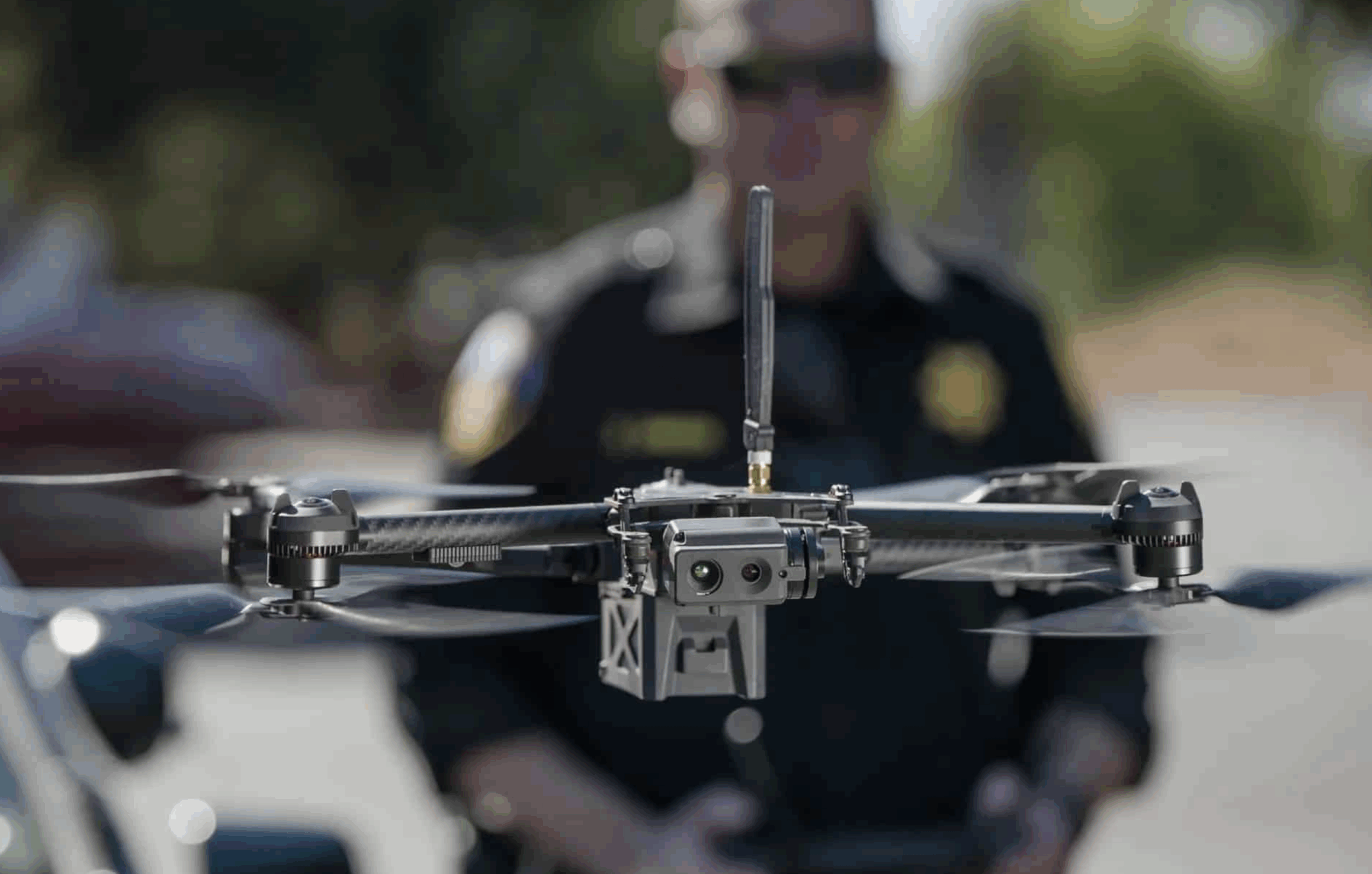
Police Departments: From Crime Scenes to Crowd Control
For many police agencies, drones have moved well beyond providing basic aerial photography. They’re now core tools for documenting evidence, reconstructing accidents, and monitoring public events. And they often do these jobs more effectively than traditional methods.
In crash investigations, drones can create detailed 3D reconstructions of a scene in minutes instead of hours, reducing road closure times and freeing up officers for other calls. Crime scene mapping is similarly effective, capturing high-resolution aerial imagery that preserves evidence exactly as found.
Tactical drones like the BRINC Lemur 2 extend these capabilities indoors. They can break glass, navigate tight spaces, and facilitate two-way communication during hostage or active-shooter incidents. Some programs go even further: In Laredo, Texas, police drones have been used to deliver Narcan to overdose scenes, arriving in time to save lives.
Drone-as-first-responder programs dramatically improve speed. Rooftop or vehicle-mounted UAVs can launch and move up to 45 miles per hour, often arriving before patrol units. In Redmond, drones in policing arrive an average of 48% faster than officers for Priority 1 calls and have reduced ground dispatches by 25%. They beat officers to the scene more than 74% of the time in Chula Vista, allowing dispatchers to make informed decisions and even cancel a ground response if it’s deemed unnecessary.
According to a Los Angeles Times report, more than 1,400 U.S. police departments already use drones in some capacity — a number that’s poised to grow as regulatory barriers ease. Recent FAA changes to visual line-of-sight requirements mean operators in approved DFR programs can fly drones beyond an officer’s direct view, enabling wider coverage areas and more flexible deployments. These changes remove one of the biggest logistical hurdles for agencies considering adoption, opening the door to safer, more proactive policing.
Fire Departments: Real-Time Assessment and Arson Investigation
Municipal fire departments are increasingly turning to drones — not to extinguish flames directly, but to assess scenes faster, investigate origins, and keep crews out of harm’s way.
Cities like Cleveland are exploring DFR programs that would send drones to 911 fire and EMS calls, streaming live video to commanders within minutes. With access to early intelligence, supervisors could determine the scale of an incident before committing trucks and personnel.
Manistee, Michigan, has already put such a program in place. Its grant-funded drone can launch in under two minutes and fly up to 55 mph, giving firefighters a rapid aerial view for spotting hotspots, detecting gas leaks, and mapping scene geometry without risking physical exposure. Drones are also being deployed to burning buildings in search-and-rescue operations, where thermal cameras can locate missing or trapped individuals far faster than ground crews.
Even when a fire is under control, UAVs continue to play a role. Thermal cameras reveal lingering hotspots and flare-up risks, while high-resolution imagery captures undisturbed burn patterns for investigators. In Kansas, the State Fire Marshal’s Office uses drones to trace how flames spread and identify likely points of origin in suspected arson cases.
The fire department in Richmond, Indiana, has gone a step further, employing photogrammetry software to generate 3D models of damaged structures within 24 hours. These digital reconstructions preserve evidence for courtroom use, support post-incident reviews, and serve as valuable training material. Drones also allow crews to examine compromised roofs and walls from above, so they can easily identify collapse risks before anyone enters the building.
Disaster Aid and Recovery
Structure fires are only the starting point for this type of application, and first responders are already attempting a much wider range of drone disaster responses.
Take wildfires, where firefighting drones equipped with infrared cameras can map hotspots through dense smoke. Without exposing crews to danger, incident commanders gain real-time visibility into fire spread so they can decide where to direct resources. More importantly, UAVs are also becoming tools for wildfire prevention. In one of the most compelling use cases, specialized “dragon’s egg” drones drop ignition spheres to conduct controlled burns, clearing underbrush to stop it from becoming fuel for catastrophic blazes.
Wildfires aren’t the only way to use drones for emergency response and disaster management. Whether for floods, hurricanes, or earthquakes, UAVs can provide rapid situational awareness when ground access is blocked. In North Carolina, for example, ultra-high-resolution drones deployed after Hurricane Helene surveyed more than 100 miles of damage in just one month — work estimated to be five to seven times faster than sending inspectors on foot. The drones identified over 1,400 points of debris and washouts, helping fast-track FEMA funding and accelerating recovery efforts.
Drone mapping and prompt communication are both pivotal in this process. By creating accurate 2D and 3D models of impacted areas, agencies can quickly assess damage, prioritize resources, and generate documentation required for federal disaster assistance. And when disasters threaten to disrupt communication and slow response coordination, companies like JOUAV are stepping in to offer drone platforms equipped with broadband mesh networking and satellite comms.
All of these speed and efficiency gains ultimately serve one overarching purpose: saving lives. Thermal imaging drones have proven critical in search-and-rescue operations, helping spot stranded residents on rooftops or locating missing people in dense terrain at night.
By sending drones into environments too dangerous or inaccessible for people, responders can make smarter decisions without putting personnel at unnecessary risk. Whether it’s guiding fire crews around a collapsing structure, pinpointing survivors after a flood, or mapping hazards before rescue teams move in, drones extend the reach of emergency services while increasing safety for both responders and the public.
Proactive Safety and Prevention for Public Events
Public gatherings and events may not be as unpredictable as the elements, but they often present significant risk to those involved. Unsurprisingly, many public officials see large crowds as yet another opportunity for drones and public safety.
The dangers of inadequate crowd management were on full display during the 2022 UEFA Champions League Final in France, where poor control measures led to dangerous bottlenecks and clashes outside the stadium. A post-event analysis suggested that real-time aerial monitoring and drone event photography could have given security teams the visibility needed to adjust on the fly, potentially avoiding some of the worst outcomes. It’s a sobering reminder of how quickly public events can reach a fever pitch — and how drones can help prevent it.
Universities have been among the first to apply these lessons. At Notre Dame, drones actively monitor football game days, providing aerial coverage of stadium approaches, parking lots, and tailgating areas. That visibility helps security teams pinpoint bottlenecks, crowd surges, or blocked emergency routes that could become problems. Colleges across the country have followed suit, turning to drones as part of broader efforts to keep fans safe during large sporting events.
Event planners and city officials are finding similar value in municipal contexts. Pre-event drone sweeps can identify line-of-sight blind spots, emergency exit obstructions, or crowd pinch points at venues like parades or concerts. Outdoor security drones can also patrol perimeters before doors open, giving teams a real-time picture of vulnerabilities. And in an age when security at large events is becoming an increasingly serious concern, UAVs provide an invaluable extra set of watchful eyes, monitoring for those who might exploit public events for theft or potential public attacks.
This isn’t for mere drone data collection — once again, the aim is saving lives and preserving public safety. Drone-based mapping and live feeds integrate into command centers, supporting coordinated drills and real-time decision-making. That means security teams can anticipate problems, act sooner, and keep participants and first responders safer.
Leveraging Drones in Public Safety: The gNext Advantage
Whether it’s using drones as a first responder or for crowd monitoring, their real value in public safety ultimately comes down to what agencies can do with the drone data they capture. And it’s here that platform choice proves decisive for turning fast-moving drone missions into decision-ready insights. And gNext does just that — transforming raw imagery into actionable intelligence for first responders and other public safety officials.
With gNext, fire, police, and emergency management teams can upload aerial or ground-based imagery directly into a secure, cloud-based workspace. Within minutes, Then, data is processed into 2D orthomosaics and 3D reconstructions, giving investigators and commanders a precise and detailed record of the scene. Whether it’s documenting a crash site, mapping a crime scene, or analyzing arson patterns, gNext delivers the accuracy and integrity required for efficient investigations and courtroom-ready evidence.
The platform also integrates seamlessly with CAD and other emergency response systems, bringing thermal, optical, and mapping outputs into one unified view. Meanwhile, AI-powered analysis accelerates post-incident reporting and predictive planning, shortening decision cycles at the scene and in the aftermath. In recent deployments, agencies have used gNext for arson investigations, hotspot detection at fire scenes, rapid accident reconstruction with drones in law enforcement, and large-scale disaster assessments to support FEMA documentation, and HazMat training and response.
Equally important, gNext keeps teams aligned. Remote analysis tools make it easy for supervisors, investigators, and command staff to collaborate from anywhere, while SOC 2 Type II compliance and AWS hosting ensure all sensitive data stays protected. The result is faster response, better coordination, and stronger outcomes — anywhere public safety is on the line.
The Future of Drones in Emergency Services and Response
The role of drones in public safety is only beginning to unfold. Beyond fire, police, and disaster response, agencies are increasingly using drones to monitor key infrastructure — bridges, roads, and utilities — further expanding their value as multipurpose safety assets.
Artificial intelligence will only cement the place of drones in disaster management, emergency response, and more. Emerging applications already show promise in automating drone data analysis, from object recognition that alerts to suspicious movements in large crowds to machine learning models that predict hazard zones using historical imagery. Responders will be free to focus less on sorting through data and more on acting quickly and decisively.
Hardware innovation is advancing as well. Projects like the FireSwarm’s ultra-heavy-lift drones point to a future where UAVs can not only scout and map wildfires but also drop suppressant payloads autonomously, even at night or in smoke-obscured conditions.
Regulators are only making it easier for agencies to expand these programs. The FAA’s evolving rules on visual line of sight will be critical for scaling DFR initiatives, ensuring drones can cover wider areas and arrive faster than ever before.
The takeaway? Drones will continue to redefine what’s possible in public safety.
And gNext is here to help agencies turn every flight into more lives saved. To see how your team can harness drones for policing, fire, emergency management, and beyond, request a demo today.


